Project overview
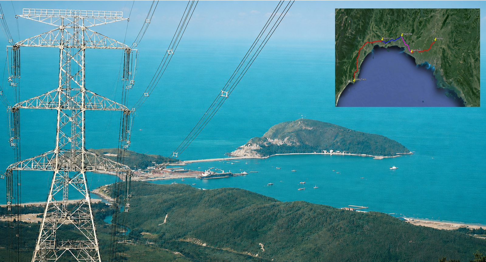
The Quang Trach – Pho Noi 500 kV Circuit 3 Transmission Line is a key national transmission project designed to increase power transfer capacity from Central to Northern Vietnam from about 2,500 MW to 5,000 MW.
The project comprises four sections
- Quang Trach – Quynh Luu;
- Quynh Luu – Thanh Hoa;
- Thanh Hoa – Nam Dinh I Thermal Power Plant;
- Nam Dinh I Thermal Power Plant – Pho Noi.
Key figures
- Line: Quang Trach – Pho Noi 500 kV Circuit 3;
- Total length: 519 km;
- Coverage: 9 provinces, 43 districts and 211 communes/wards;
- Total tower locations: 1,177;
- Pile foundation locations: 239;
- Total investment: more than VND 22,300 billion.
Challenges
01. Large scale – exceptionally tight schedule
Survey work stretched along a 519 km route, while data had to be completed, checked and delivered quickly to keep pace with design, site clearance and construction running in parallel.
02. Complex terrain and access
The route crosses plains, ponds, swamps, rivers, forests and high mountains. Many tower locations are far from roads, on steep slopes or in areas where moving people and equipment is difficult.
03. Weather
Site conditions ranged from intense heat to heavy rain, storms and floods, muddy access roads and waterlogging, requiring flexible organization, rapid mobilization and strict safety control.
04. Constantly changing geology and foundations
Geological conditions changed along each section, from soft ground, clayey mud and flooded areas to hills, weathered rock and landslide-prone locations.
05. Many critical crossings
The line crosses rivers, lakes, expressways, national highways, railways, existing power lines, dense urban areas and other infrastructure. These locations require precise survey data to control spans, heights and safety clearances.
06. Consistent data along the entire route
Many survey teams worked simultaneously in different areas, so coordinate and elevation systems, technical standards, measurement procedures and data structures had to be controlled consistently.
07. Multiple provinces
Surveying an inter-provincial project required PSC to coordinate with many localities, authorities and land users at once. Differences between provinces in planning, cadastral records, base data, site access procedures and land handover schedules added to the complexity.
Our approach
PSC deployed multiple survey teams simultaneously along the route, prioritizing complex terrain, special foundation locations and critical crossings.
Data were processed and delivered in batches rather than waiting for the whole route, so design teams could start immediately on sections with complete data.
Execution focused on
- Dividing the route into suitable survey zones;
- Mobilizing personnel and equipment in parallel;
- Consistent control of coordinates and elevations;
- Direct coordination between topographic and geological surveys and design;
- Rapid data checks immediately after collection;
- Prioritizing complex foundation locations and crossings;
- Updating and supplementing data as design required.
Resources deployed
People
PSC deployed multiple survey crews and teams across the sections within its assigned scope, including:
- Surveying engineers;
- Engineering geologists;
- Drilling, sampling and in-situ testing staff;
- Data processing, checking and management staff;
- Logistics and site access support teams.
Teams were assigned to each section and worked to a very tight schedule while comply with the site organization plan and safety control measures and coordinating within a single management system.
Equipment
PSC deployed a complete set of equipment for surveying across many types of terrain:
- High-precision GNSS receivers;
- Total stations and levels;
- Profile measurement, positioning and route survey equipment;
- Drones for topographic data collection;
- UAVs acquired to transport equipment and samples to hard-to-reach locations;
- Geological drilling rigs and specialized drilling equipment;
- Sampling, penetration and in-situ testing equipment;
- PSC laboratory: flexible work shifts matched to equipment capacity, with controlled samples/tests and a detailed handover schedule.
Technology
PSC applied and integrated survey and data processing technologies suited to the scale of the route:
- Satellite positioning and high-precision control networks;
- Digital surveying and terrain modelling;
- UAV technology for large or hard-to-reach areas;
- Specialist software for plans, profiles and route data;
- Integration of topographic, geological and foundation location data;
- Standardized coordinates, elevations and data structures;
- Cross-checking and multi-level quality control;
- Digital data sharing for rapid coordination between surveying and design.
Results and capabilities demonstrated
All four sections of the Quang Trach – Pho Noi 500 kV Circuit 3 line were completed in August 2024 after just over six months of construction – an exceptional pace for a project of this scale.
The project demonstrates PSC’s ability to rapidly mobilize large-scale survey resources, run multiple teams simultaneously across regions, keep data accurate and consistent, and meet the exceptionally urgent schedule of a key national transmission project.
Over more than 500 km from Quang Trach to Pho Noi, PSC turned thousands of survey points into an accurate, consistent and timely technical dataset – helping a key national transmission project finish in record time.