
01
01
MACHINERY
AND EQUIPMENT
MACHINERY · EQUIPMENT · TECHNOLOGY
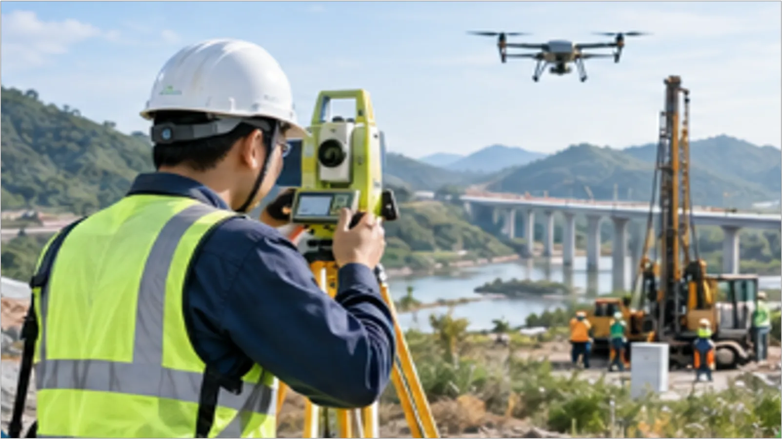
PSC owns surveying, geotechnical drilling, testing and data processing equipment serving a wide range of structures, terrain and working environments. These resources support an integrated workflow, from positioning, surveying, existing-condition scanning, underground investigations, hydrographic surveys and aerial imaging to exploratory drilling, sampling, field and laboratory testing, and technical data processing.
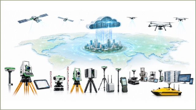
Key equipment includes GNSS and RTK systems, high-precision total stations and levels, 3D laser scanners, ground-penetrating radar (GPR), survey UAVs, echo sounders, geotechnical drilling systems, CPTu equipment, pontoons and drilling platforms for marine surveys, as well as testing equipment for soil, rock, concrete, aggregates and steel.
Specialized equipment, licensed software, automated data acquisition systems and experienced technical personnel enable PSC to select suitable solutions for each assignment. Together, they improve the accuracy, verifiability and consistency of input data for design, construction, acceptance and facility operation.
01
MACHINERY
AND EQUIPMENT
02
TECHNOLOGY
DIGITAL
SUPPORTING PSC’S TEAM IN DELIVERING RELIABLE, HIGH-QUALITY OUTPUTS
01
EQUIPMENT GROUP
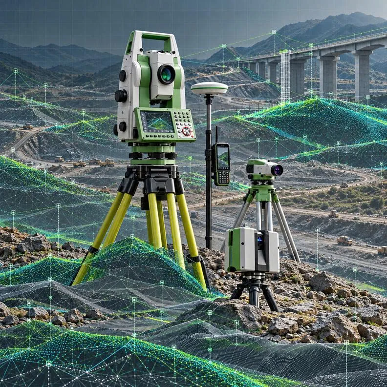
PSC invests in and proficiently operates advanced equipment for surveying, 3D laser scanning, GNSS positioning, geological investigations and testing, supplied by reputable specialist manufacturers worldwide, such as Leica TM50, Leica LS15, Leica DNA-03, Stonex S900A GNSS, GS-10 and RTK systems.
This equipment establishes a consistent coordinate and elevation reference framework, ensuring accurate input data, supporting error control and reducing risks in design, construction, acceptance and structural monitoring.
TASKS PERFORMED
KEY EQUIPMENT Leica TM50, Leica LS15, Leica DNA-03, Stonex S900A GNSS, Leica GS-10 and RTK systems.
SURVEYING INSTRUMENT
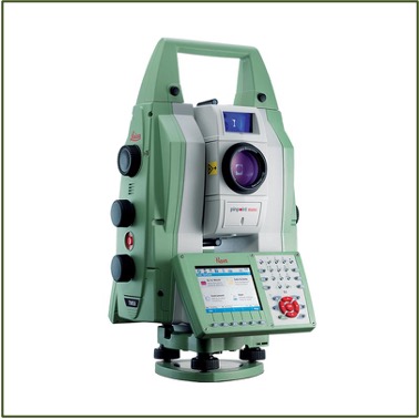
LEICA NOVA TM50
A high-end instrument from Leica Geosystems designed for displacement and deformation monitoring with millimetre-level precision. Beyond conventional total station surveying, it offers angular accuracy of up to 0.5″, distance measurement accuracy with a prism of 0.6 mm + 1 ppm and a measuring range of up to 3,500 m; it also supports automatic target recognition and continuous monitoring.
DIGITAL LEVEL
LEICA LS15
A high-precision digital level used to establish vertical control networks, measure height differences, verify elevations and monitor structural deformation. Accuracy of up to 0.2 mm/km with a precision Invar staff. The LS15 stands out with a digital camera that assists staff sighting and autofocus.
GNSS
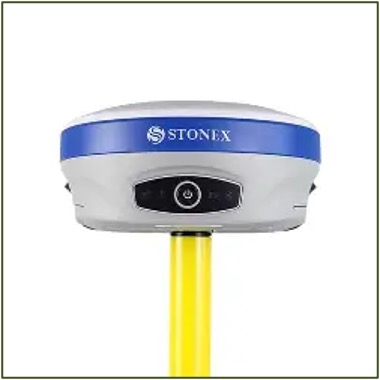
STONEX S900A GNSS
A professional surveying GNSS receiver supporting multiple satellite constellations and RTK positioning for control networks, topographic surveying, positioning and construction setting-out; 1,408 channels, supports GPS, GLONASS, BeiDou, Galileo and QZSS, with 4G, Bluetooth/Wi-Fi and UHF connectivity; IMU optional.
LEVELLING
LEICA DNA-03
High-precision digital level. The Leica DNA-03 is a specialized digital level used for high-precision elevation measurement and height difference determination. It supports automatic barcode staff readings, measurement data processing and storage, improving efficiency in surveying, elevation control, and structural deformation monitoring for construction and infrastructure projects.
GNSS
LEICA GS10
High-precision GNSS receiver. The Leica GS10 is a specialized GNSS receiver used for surveying, positioning, and precise coordinate determination in surveying and construction. It supports the establishment of survey control networks, topographic surveys, positioning of structural elements, and the collection of spatial data for design, construction, and asset management.
GNSS – RTK
RTK SURVEYING SYSTEM
Real-time GNSS positioning system. The RTK (Real-Time Kinematic) surveying system is a GNSS positioning system that uses real-time kinematic technology to determine coordinates and elevations with high accuracy. It is used for topographic and cadastral surveys, establishing survey control networks, construction setting out, and spatial data collection, helping improve efficiency, reduce surveying time, and meet the technical requirements of construction and infrastructure projects.
02
EQUIPMENT GROUP
PSC invests in 3D laser scanners, scanning total stations, aerial imaging systems and specialized software from globally recognized manufacturers in surveying and spatial data technology. These include the Trimble SX12 and Trimble X7 – advanced instruments that support accurate three-dimensional data capture, digitization of existing conditions and integrated data processing workflows from the field to the office.
PSC uses its 3D laser scanners, aerial imaging systems and processing software to deliver survey data within a consistent coordinate and elevation reference framework, ensure accurate input data, support survey error control and reduce risks in design, construction, acceptance and structural monitoring.
TASKS PERFORMED
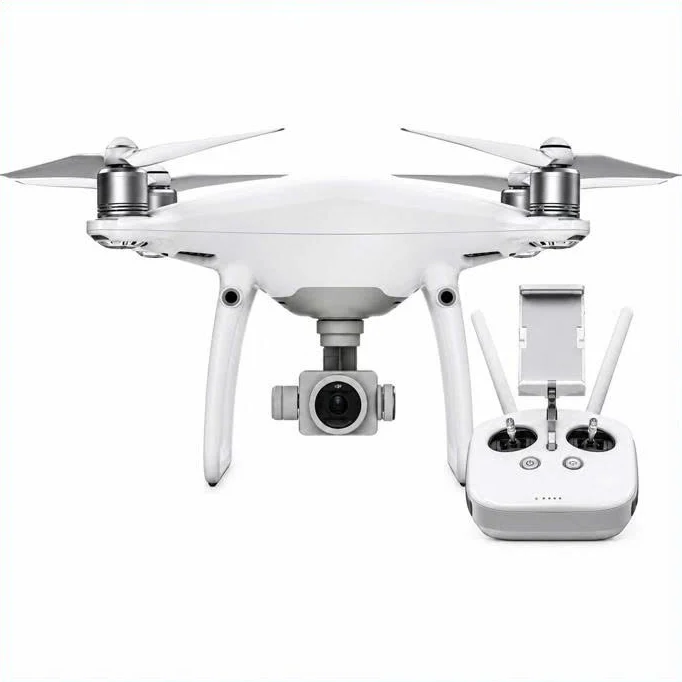
KEY EQUIPMENT Trimble SX12 3D scanning total station, Trimble X7 3D laser scanner, Geoscan 101Pro UAV, Phantom 4 Pro and specialized data processing software.
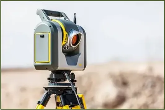
TRIMBLE SX12 – 3D SCANNING TOTAL STATION
Combines a high-precision total station with a 3D laser scanner for surveying, positioning, existing-condition scanning and 3D point-cloud acquisition. Angular accuracy: 1″; scanning speed: up to 26,600 points per second.
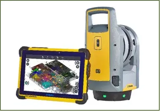
TRIMBLE X7 – 3D LASER SCANNER
A professional 3D laser scanning system that rapidly captures spatial data to generate point clouds, 3D models and existing-condition documentation; features automatic levelling, self-calibration and on-site scan registration.
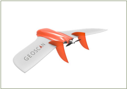
GEOSCAN 101 PRO – UAV FOR TOPOGRAPHIC SURVEYING
A fixed-wing UAV designed for aerial photogrammetry and surveying, supporting large-area surveys, topographic mapping, orthophoto generation, digital elevation models and 3D models. Supports autonomous flights with a flight time of up to approximately 60 minutes.
03
EQUIPMENT GROUP
PSC’s ground-penetrating radar, echo sounding, hydrographic surveying, sampling and marine drilling equipment enables surveys extending from the ground surface into subsurface spaces and from the water surface to the riverbed or seabed. These systems generate continuous data on underground infrastructure locations, bottom topography, sediments and geological conditions to support design, construction and the safe management of structures.
TASKS PERFORMED
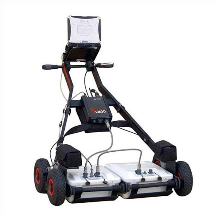
KEY EQUIPMENT RIS MF HI-MOD ground-penetrating radar, Hydrotrac II echo sounder, HYPACK MAX hydrographic surveying software, DMS-550 motion sensor, marine drilling pontoons, gravity corers and an piezocone penetration testing (CPTu) system.
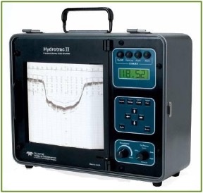
HYDROTRAC II – ECHO SOUNDER
An echo sounding instrument for determining water depths and bottom topography in rivers, lakes, coastal waters and other water bodies, providing input data for bathymetric mapping.
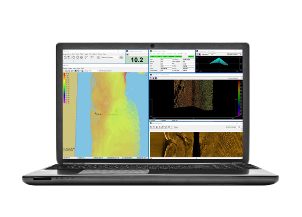
HYPACK MAX
A specialized software solution for survey line planning, depth data acquisition, editing and processing, and the production of bathymetric plans, cross-sections and other hydrographic survey deliverables.
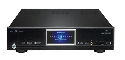
DMS-550 – MARINE MOTION SENSOR
A motion sensor that records the movement of survey vessels and provides correction data to compensate for the effects of vessel motion on depth measurements.
MARINE DRILLING PONTOON PLATFORM
A floating platform system for deploying drilling equipment and conducting geological and geotechnical investigations in rivers, lakes, coastal waters and offshore areas.
GRAVITY CORER
A gravity-driven sampling device for collecting soil and shallow sediment samples beneath the seabed, supporting the assessment of geological conditions, sediment composition and sediment layer characteristics.
piezocone penetration testing (CPTu) system
A system for conducting piezocone penetration tests (CPTu) beneath the riverbed or seabed. The equipment provides data on cone tip resistance, sleeve friction and pore water pressure to support stratigraphic profiling and the assessment of geotechnical characteristics for marine structure foundations.
04
EQUIPMENT GROUP
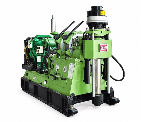
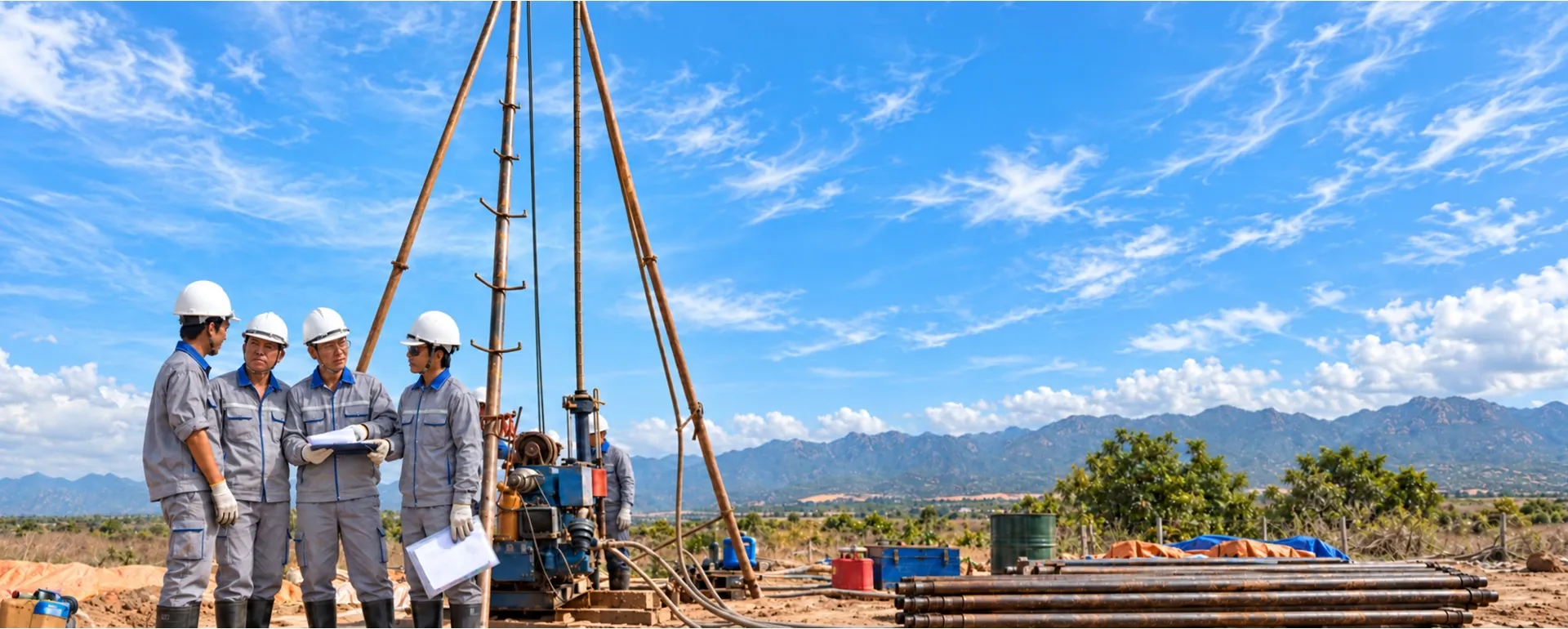
PSC’s drilling rigs and field testing equipment enable direct investigation of subsurface stratigraphy and in-situ ground characteristics, generating reliable geological data for foundation design, ground improvement selection, risk prediction and structural safety control.
TASKS PERFORMED
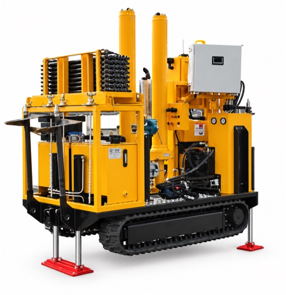
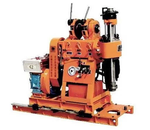
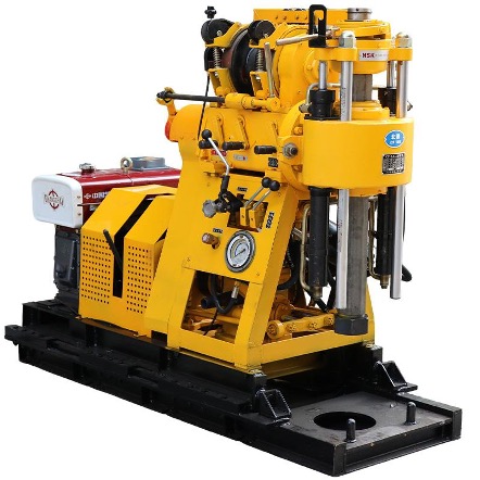
KEY EQUIPMENT XY-1, XY-1A-4, XY-42A, UKB-12/55, GK-250, GX-50 and JX-50-1 drilling rigs, and a GeoMil CPTu system.
XY-1 DRILLING RIG
A portable geological drilling rig for geological and geotechnical investigations, core sampling and determining subsurface geological conditions.
XY-1A-4 DRILLING RIG
A geological drilling rig for investigation boreholes, soil and rock sampling, and determining stratigraphic structure; used in engineering geological, geotechnical and foundation investigations.
XY-42A DRILLING RIG
A geological drilling rig designed for investigation drilling and rock core sampling to determine the structure, composition and geological characteristics of the ground at project sites.
GK-250 DRILLING RIG
A geological drilling rig for investigation drilling, sampling and determining subsurface geological conditions, used in engineering geological and geotechnical investigations.
GX-50 DRILLING RIG
Drilling equipment for geological and geotechnical investigations, supporting borehole drilling, soil and rock sampling, and geological data collection for foundation assessments.
JX-50-1 DRILLING RIG
A geological investigation drilling rig for exploratory drilling, soil and rock sampling, and determining stratigraphic characteristics, supporting engineering geological investigations and foundation design.
05
LABORATORY
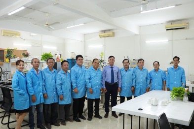
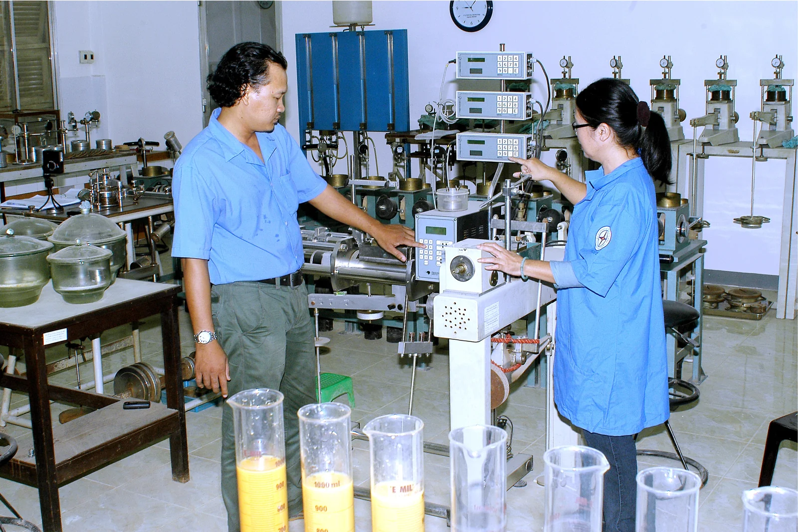
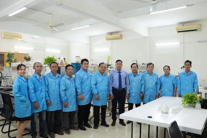
PSC’s own laboratory and specialized equipment enable independent testing of soil, rock and material characteristics, streamline coordination between fieldwork and laboratory testing, and enhance data control, traceability and use in design, construction and acceptance of works.
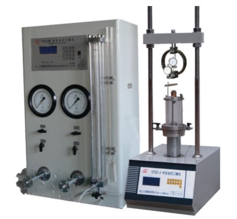
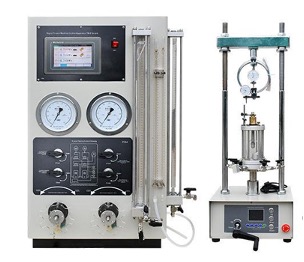
KEY EQUIPMENT TSZ-30-2.0 and TSZ-3 triaxial testing machines; WG three-station consolidation apparatus; ZJ four-station direct shear apparatus; Matest 1,200 kN compression testing machine; TYA-2000 concrete and rock compression testing machine; TYA-300 cement compression testing machine; WE-1000-B steel tensile testing machine; D504/2 Los Angeles abrasion testing machine; TLS-100 thermal conductivity meter; and automated data acquisition systems.
TSZ-30-2.0 – SOIL TRIAXIAL TESTING APPARATUS
Geotechnical testing equipment used to determine soil shear strength and shear strength parameters under various stress conditions. The TSZ30-2.0 model has a maximum compressive load capacity of 30 kN.
TSZ-3 – STRAIN-CONTROLLED TRIAXIAL TESTING APPARATUS
Equipment used for soil triaxial compression testing to determine deformation characteristics and shear strength under controlled stress conditions.
WG-1B – TRIPLE CONSOLIDATION TESTING APPARATUS
Equipment used to determine soil compressibility and consolidation characteristics through the relationship between applied load and specimen deformation.
ZJ – FOUR-UNIT DIRECT SHEAR TESTING APPARATUS
Equipment used to determine soil shear strength by applying different normal loads and horizontal shear forces to soil specimens.
MATEST – 1,200 kN – COMPRESSION TESTING MACHINE
A high-capacity compression testing machine used to determine the compressive strength of construction materials.
TYA-2000 – CONCRETE AND ROCK COMPRESSION TESTING MACHINE
A high-capacity compression testing machine used to determine the compressive strength of concrete, rock and other construction materials, with a maximum load capacity of 2,000 kN.
TYA-300 – CEMENT AND MORTAR COMPRESSION TESTING MACHINE
Equipment used to determine the compressive and flexural strength of mortar and cement, supporting quality assessment of construction materials.
WE-1000B / WEW-1000B – STEEL TENSILE TESTING MACHINE
Equipment for testing the mechanical properties of materials, with a maximum testing force of 1,000 kN. It is used to determine the tensile strength, yield strength and elongation of steel, and to perform compression, bending and shear tests, depending on the configuration.
LOS ANGELES ABRASION TESTING MACHINE
Equipment used to determine the abrasion loss and abrasion resistance of stone aggregates by rotating specimens together with steel balls in a drum in accordance with the testing procedure.
TLS-100 – THERMAL CONDUCTIVITY METER
Equipment used to measure the thermal conductivity and thermal resistivity of soil, rock, concrete and certain other materials.
AUTOMATIC DATA ACQUISITION SYSTEMS
Automatic data acquisition systems connect to force, displacement, pressure and strain sensors, as well as specialized probes, enabling continuous recording of parameters throughout testing.

06
DIGITAL TECHNOLOGY
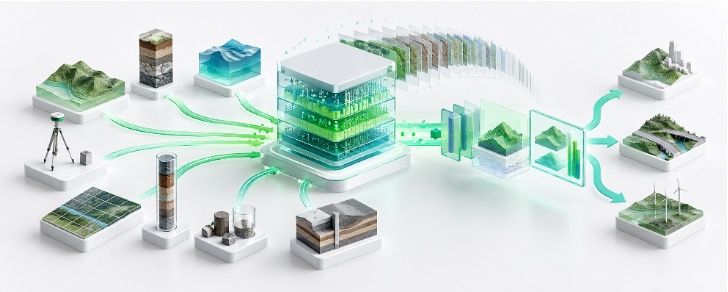
PSC is progressively transforming field survey data into structured digital data that can be integrated, analyzed, visualized and reused throughout the lifecycle of a facility.
By combining survey data platforms with GIS, 3D reality capture technology and data standards supporting BIM, PSC provides reliable input data for design, construction, asset management and the development of Digital Twin systems.
6.1
INTEGRATED SURVEY DATA PLATFORM
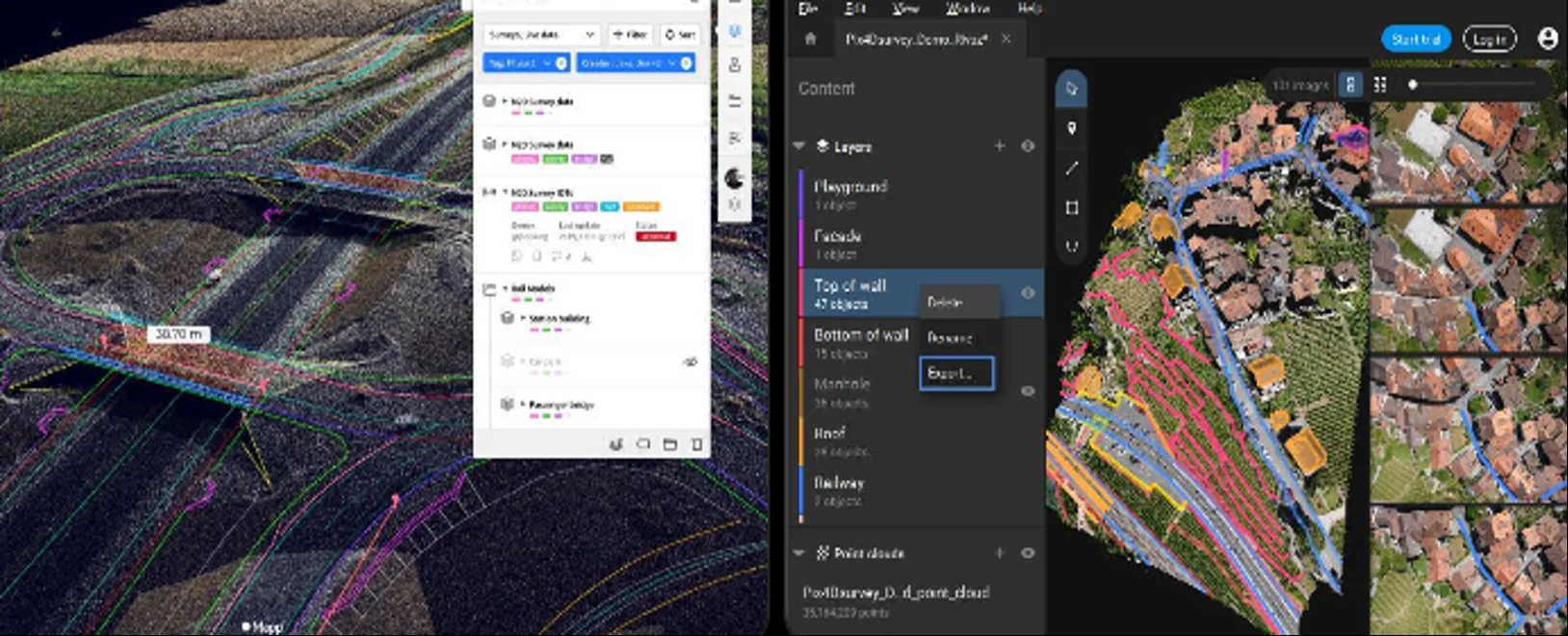
PSC uses spatial data management platforms, survey databases and common data environments to integrate, organize and manage survey results from multiple sources, transforming fragmented data into structured data assets that can be retrieved, controlled, updated and reused.
Data is managed by project, location, time, data type and facility element, forming a structured survey database that facilitates retrieval, verification, updating and reuse.
6.2
SPATIAL MAPPING AND ANALYSIS OF SURVEY DATA – GIS
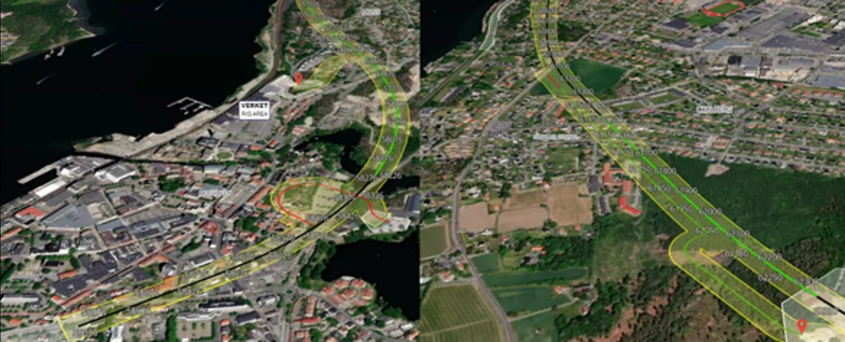
This software transforms survey data into spatial data that can be viewed, analyzed and used based on location.
GIS links survey data to geographic locations, enabling the integration and visualization of data layers covering topography, geology, hydrology and the existing conditions of facilities and infrastructure.
Using survey data, PSC can develop digital maps, terrain models and spatial data layers to analyze existing conditions, assess site conditions and support decision-making.
6.3
3D REALITY CAPTURE AND DATA FOR BIM
A group of technologies that provides reliable digital data on existing conditions, ready for integration into the project’s BIM environment.
Using UAVs, LiDAR and 3D laser scanners, PSC captures existing facility and terrain conditions as point cloud data and 3D models.
Point clouds, DTM/DSM data and existing-condition models can be standardized, organized and delivered as input data for design consultants, BIM consultants or facility information management systems.
PSC focuses on producing accurate existing-condition data rather than replacing the role of BIM design consultants.
6.4
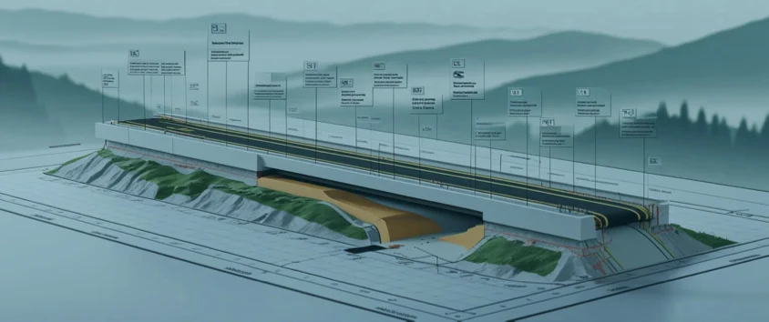
DIGITAL TWIN – SURVEY DATA FOR DIGITAL FACILITY MODELS
A group of technologies that creates a reliable field data layer, helping digital models more closely reflect actual facility conditions.
Digital Twins are developed on the foundation of digital facility data and the ability to update information from the physical world.
PSC can contribute to the Digital Twin ecosystem by surveying, capturing and updating existing-condition data using GNSS, UAVs, LiDAR, 3D laser scanners, bathymetric surveying and monitoring.
Survey data updated over time can provide information for creating, validating and updating digital facility models during design, construction, condition inspection and operation.
View details →
View details →
View details →
View details →

View details →

View details →

View details →